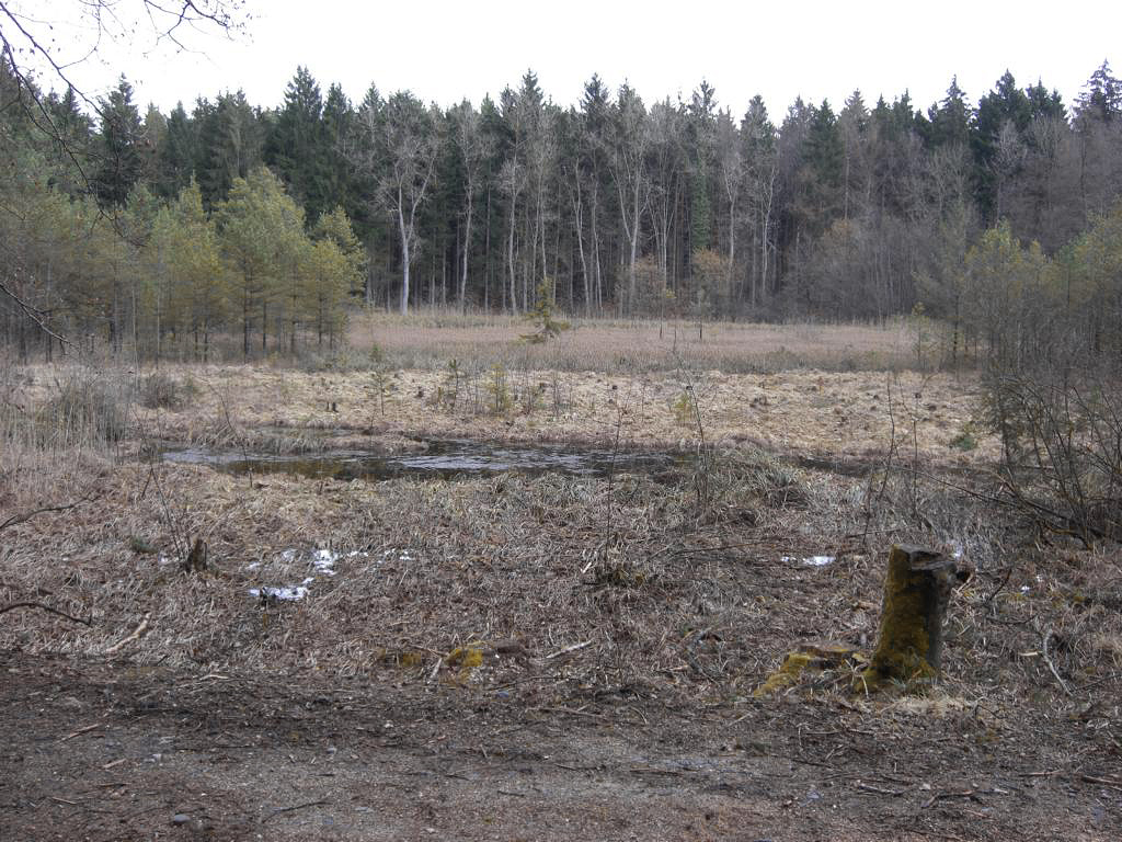
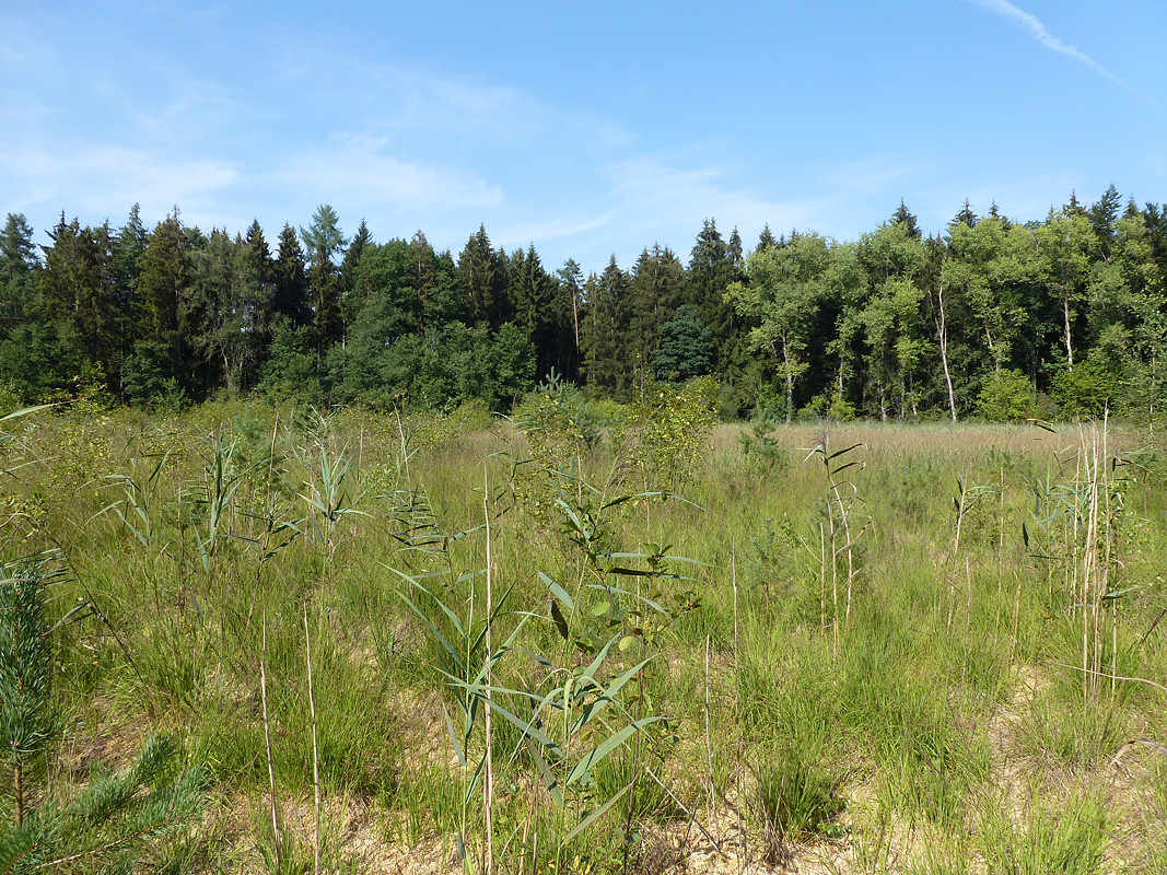
The Simmelried is an approximately three hectare-sized wetland in southern Germany. It is 2 km off Lake Constance, near the village of Hegne, which belongs to the city of Constance (s. “Google maps” below). The area is 417 m above sea level.
The Simmelried was formed after the last (Würm) ice age, 14.000–15.000 years ago, when the regressing glacier tongue produced a terrain with water filled depressions between Drumlins (subglacial streamlined boulder depositions). The majority of these waters turned to moorland through a process of silting. However, the rise of the ground water level prevented the formation of a highmoor. During the last hundred years, most parts of the moor were destroyed by peat cutting. The remaining patches of peat were filled with water and commenced to silt up again.
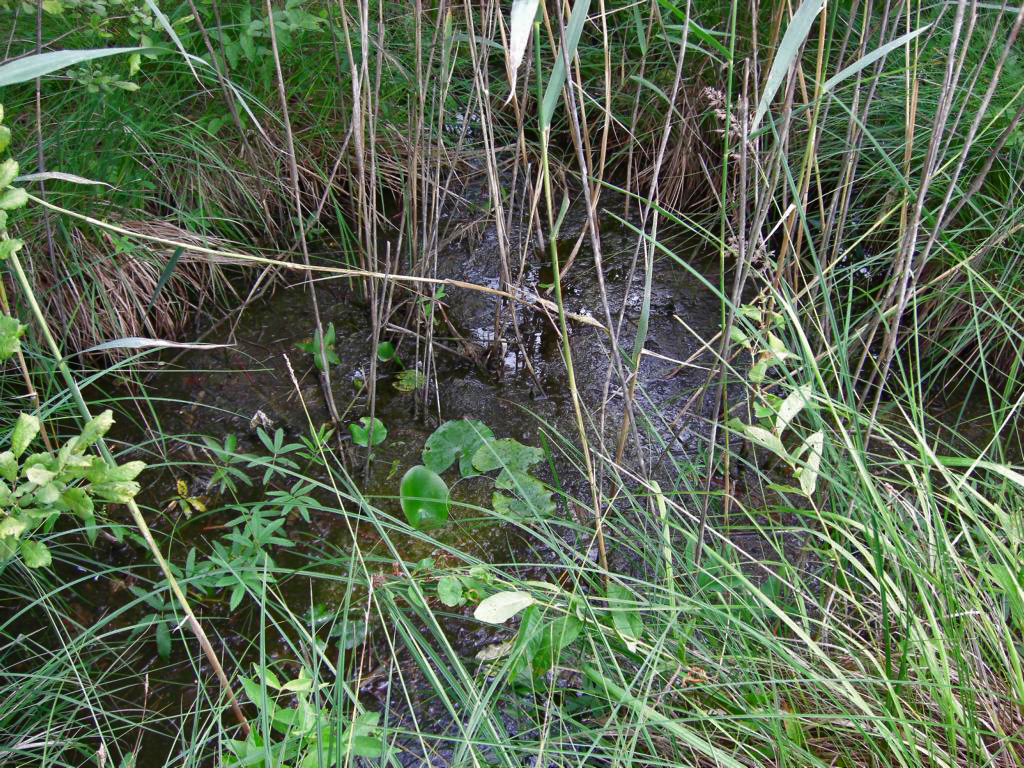
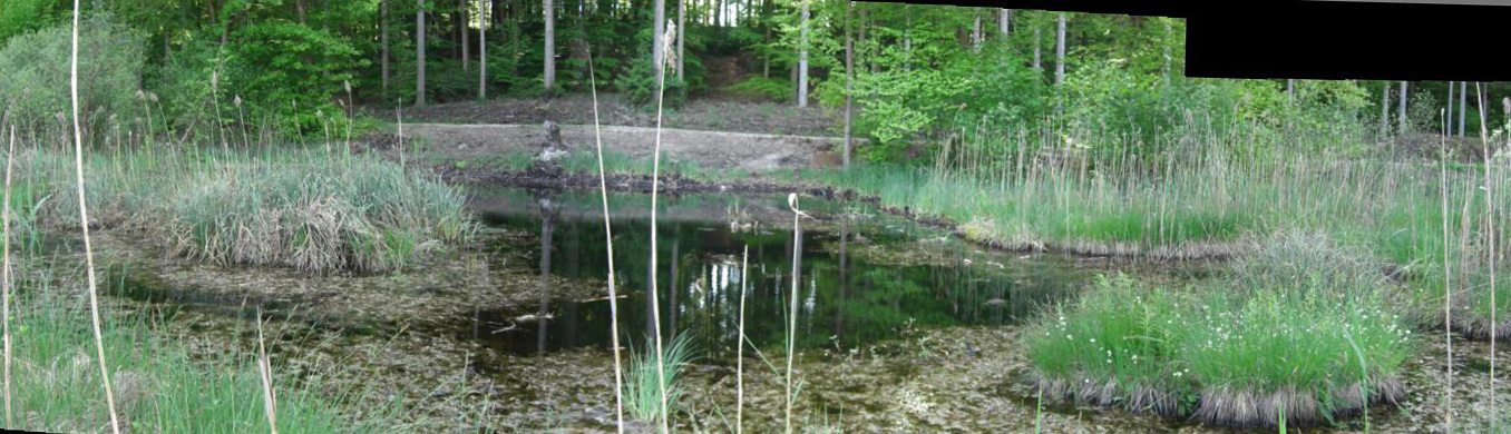
The outlet of the Simmelried is an artificial, straight canal in the northwest; it is filled with an up to 2 m deep mud layer; active outflow occurs only after strong rain. Otherwise, the water stays in the canal and can even dry out in a hot summer. The wetland is surrounded by hills covered by an approximately 50-years-old forest composed of beech, oak, and spruce. At the southwest margin of the Simmelried rises a range of hills to a height of about 100 m. No part of the wetland borders an agricultural area. Thus, there is no inflow of fertilizes or pesticides, and the nutrient input takes place through the spring water, and, especially, the leachate from the forested hills. Obviously, the leachate contains a lot of nutrients, especially in autum when the leaves are decomposed. The varying water composition of the small ponds can be recognized by the different plant communities. Additionally, the intensity of the brownish water colour varies throughout the year. While the water seeps through the Schwingmoor and the reed belt to the spillway, the plants extract the nutrients, but the water does not acidify and leaves the Simmelried with pH 7. The pH of the small ponds is between 5 and 6. Such values were already recorded by Franke (1980, s. Literature), who studied the dragonflies of the Simmelried.
2. History since 1993
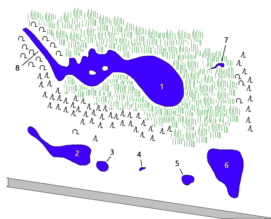
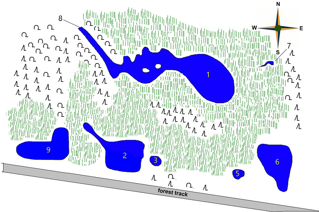
In July 1993 I discovered the Simmelried as a hot-spot of microscopic life rather by chance during a walk in the forest near the village Hegne. It was difficult to discover it from the forest path, because the open water areas were surrounded by a dense reed belt. However, I could hear frogs and so I then discovered the open water areas behind the reed belt. At that time I was able to identify a total of 7 open water areas in Simmelried (s. Fig. 1).
Fig. 1: Schematic sketch of the ponds in Simmelried as they existed in 1993.
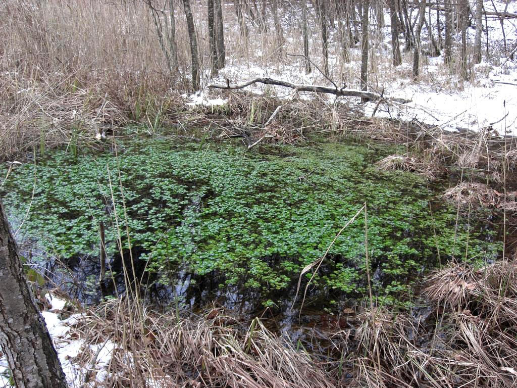
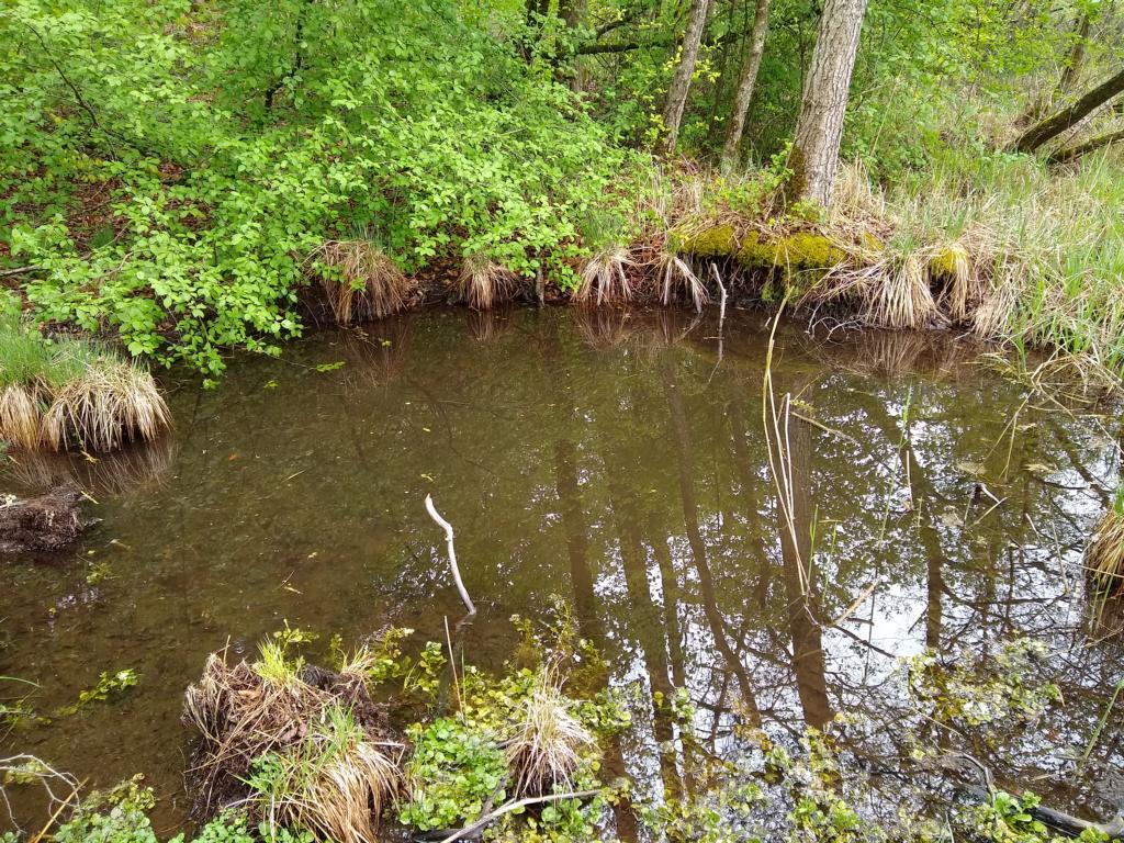
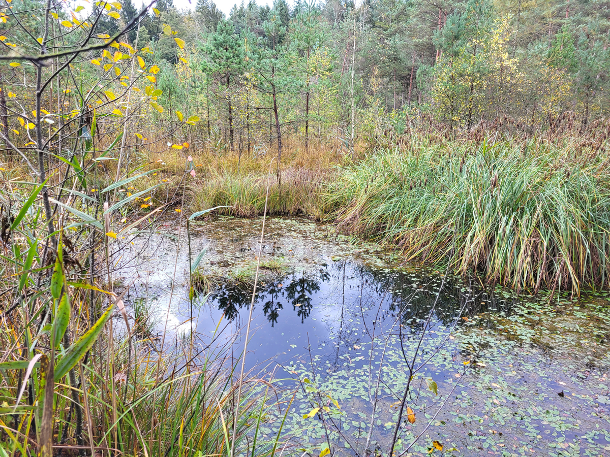
The main pond (1) in the north of the site was surrounded by a wide belt of reeds (Phragmites communis) and mud. Thus, the main pond 1 was not accessible, except in winter, when the water frozens. In fact, since 1993 I sampled exclusively the side ponds 2 – 6 located in the southern part, the spring pool 7 and the outlet channel 8. The small ponds 2 –6 with a size between 5–50 m2 were surrounded by Schwingmoor composed of Great fen-sedge (Cladietum marisci) and Sphagnum moss (Sphagnum fallax). The water of the spring 7, located at the eastern boundary, flows in a drain directly into the main pond 1. A belt of reed (Phragmites communis) and pines (Pinus silvestris, Pinus mungo) separates the large pond from the small ponds. At that time I found all the water surface overgrown with white sea-lily (Nymphaea alba), except for the small pond 4.
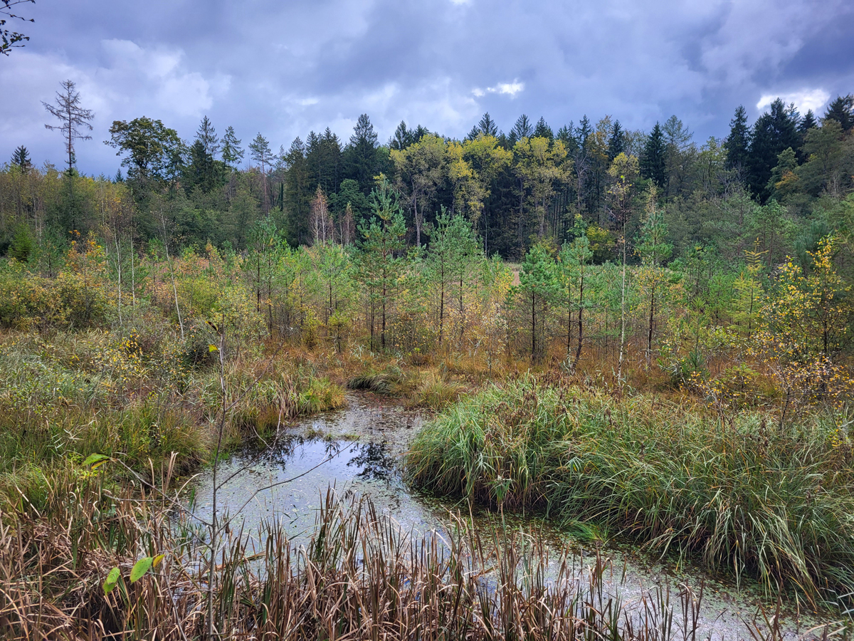
Since 1993 until today, Simmelried has changed in many ways. Through my regular visits and examination of the samples, I have been able to document many of these changes. I found the Simmelried enormously rich in species at that time. This concerned not only the microscopic life, but also plants, insects and amphibians. There were many dragonflies, pond newts, water frogs and grass snakes. In all the samples I drew, there were very many aquatic insects, leeches and water beetles. The microscopic species diversity of interest to me was extremely rich and also differed in some cases from pond to pond. Over time, this species diversity has greatly decreased in all areas. In my estimation, this trend has intensified since the year 2010. Today one finds practically no more water insects and only few dragonfly species. Pond newts and grass snakes have also disappeared. Only a few frogs are still to be found. At the same time, a slow siltation has started in all ponds, which continues until today.
Fig. 2: View on the pond 2 from south in July 1993.
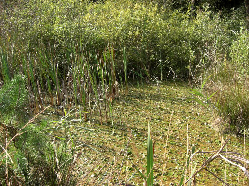
Fig. 3: The pond 2 covered with white sea-lily July 1995.
Fig. 4: The pond 2 with the belt of pines in the background in July 1995.
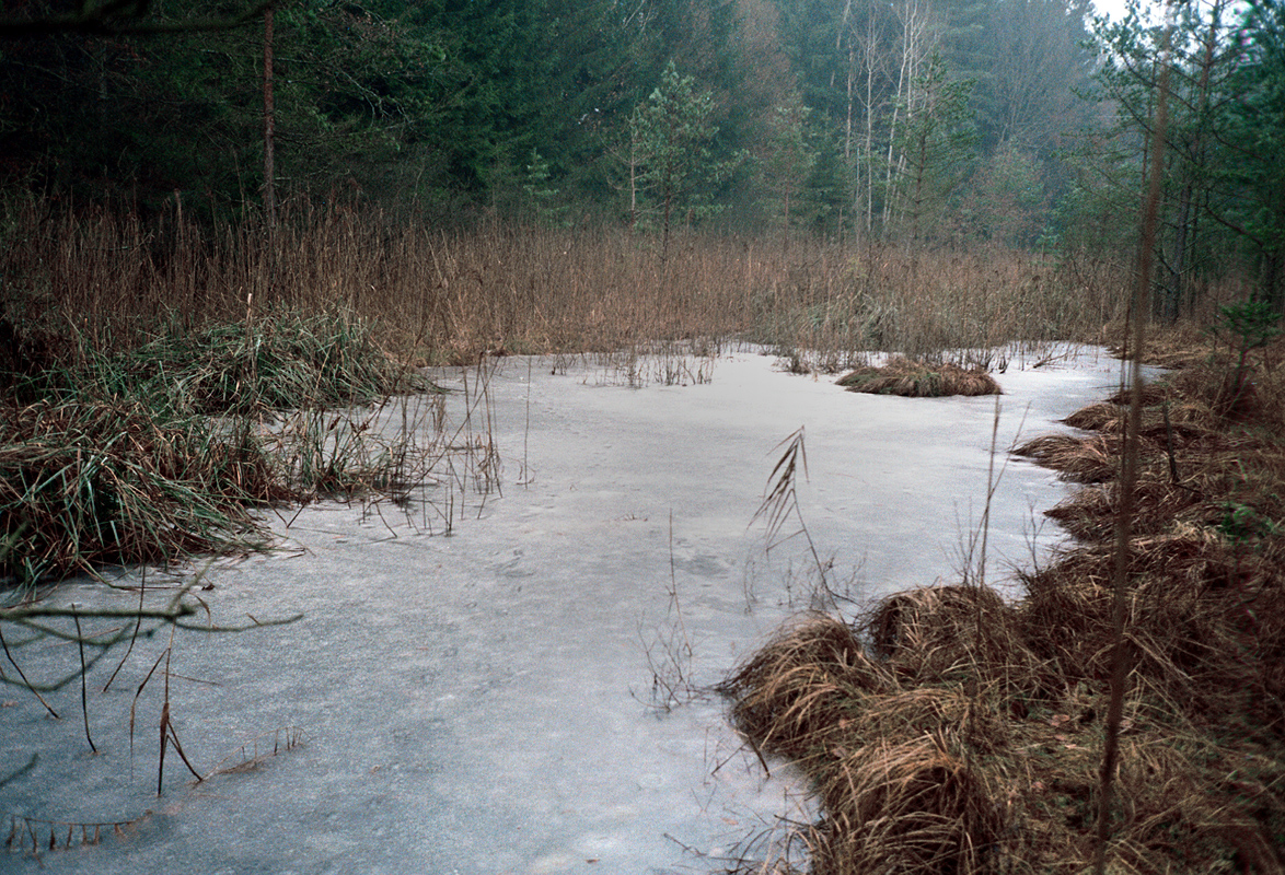
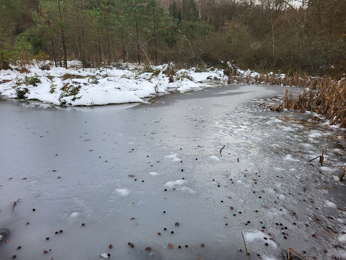
Fig. 5: The frozen pond 2 in December 1998.
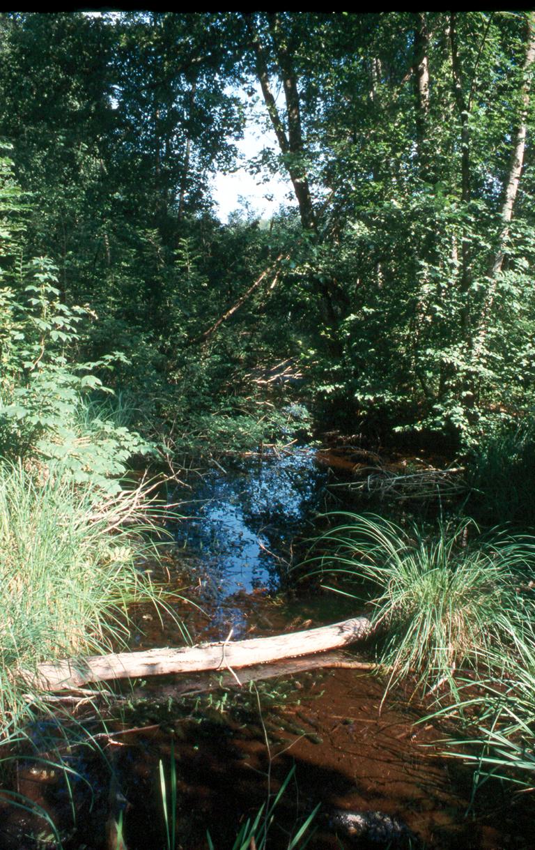
Fig. 6: The outlet channel 8 in July 2003.
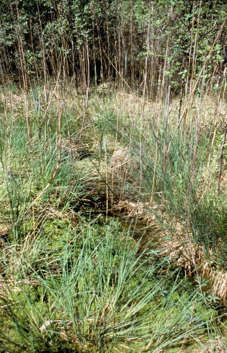
Fig. 7: The pond 4 in May 2005.
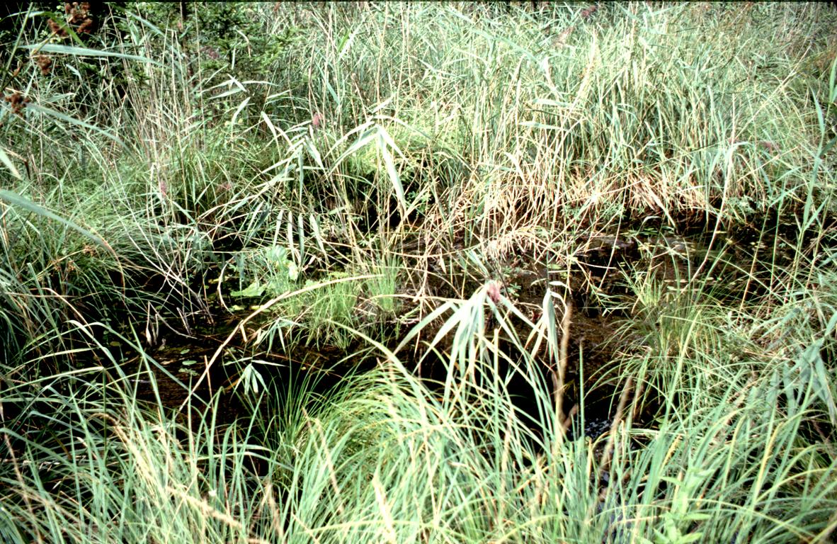
Fig. 8: Pond 3 in August 2005.
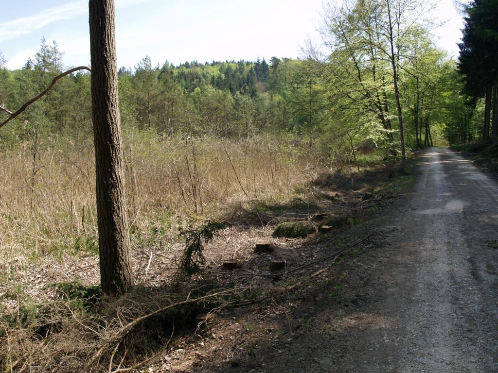
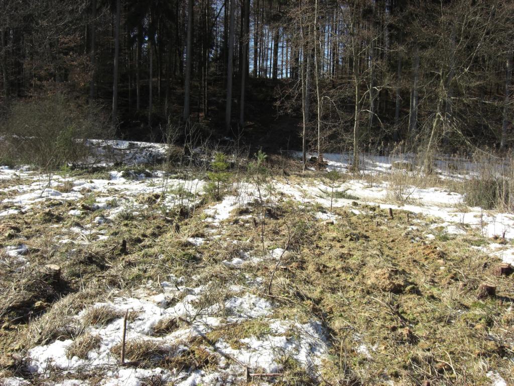
Fig. 9: In Winter 2006/2007 many of the trees bordering the Simmelried to the south were cut. Image from April 2007.
Fig. 10: The small pond 5 in July 2008.
Fig. 11: The pond 6 in July 2008.
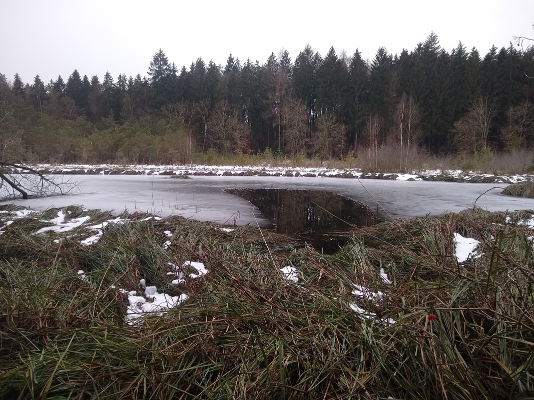
Fig. 12: The frozen pond 6 in December 2008.
Fig. 13: The spring 7 in January 2009 covered with watercress (Nasturtium officinale).
Fig. 14: The pond 6 in October 2009. Note the Cattails (Typha latifolia) as the first sign of siltation.
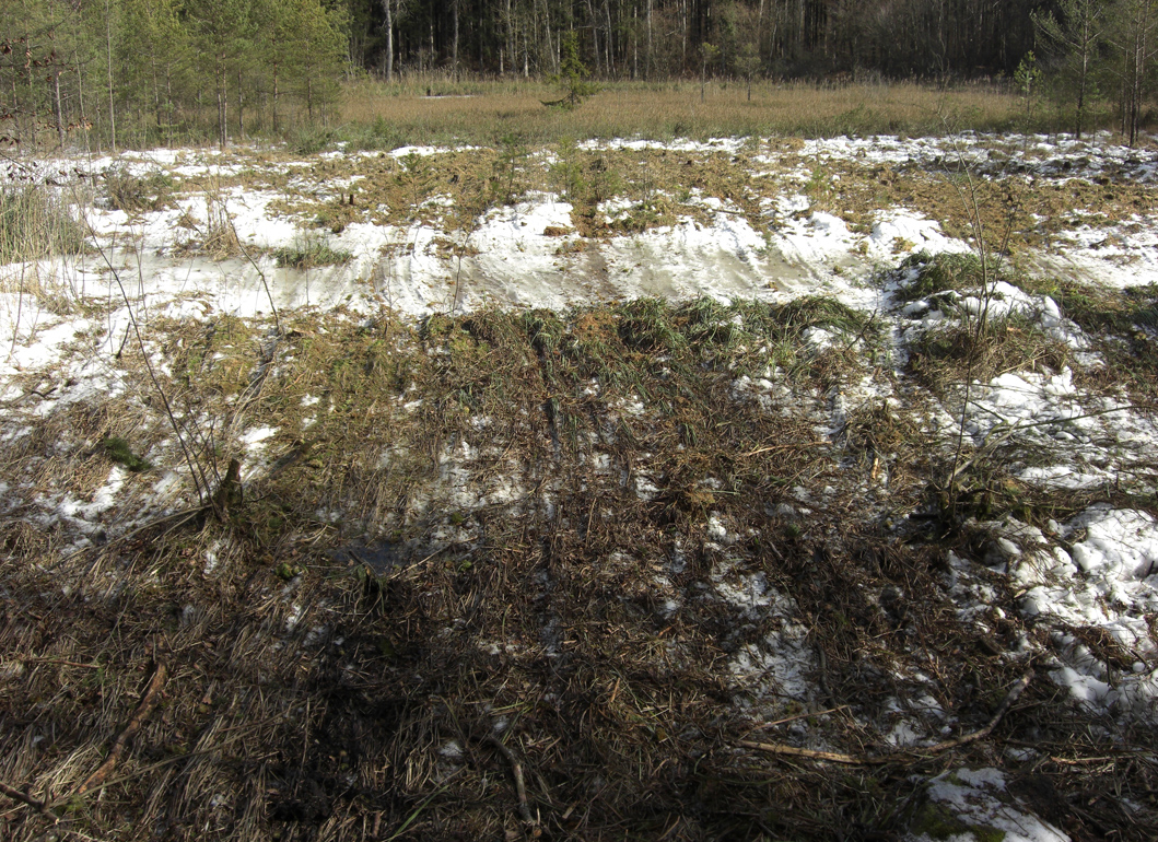
In February 2010, the Simmelried was completely frozen over during a prolonged freeze and a swath was cut into the pine stand behind pond 2. On the frozen ground they could be pulled out with machinery.
Fig. 15: The same view as in the previous image but one month later in March 2010. The cut gap in the pine stand in the background is visible.
Fig. 16: The traces of a tractor in front of pond 2 used to pull the cut pines.
Fig. 17: View in the direction of pond 2 in February 2010. In the background the stumps of the felled pines can be seen, which were then pulled out over the frozen pond. The pulling down of the felled pines has destroyed all the riparian vegetation.
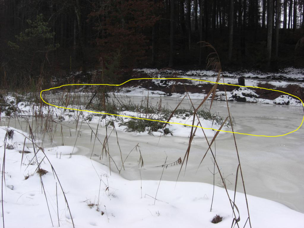
After the pine trees were cut down in the winter of 2010, a new pond was created with an excavator, pond 6 was deepened, and pond 2 was widened. This was a serious intervention in the ecosystem and it was feared that the Simmelried would lose its (microscopic) biodiversity as a result. Fortunately, however, the existing thick layer of mud in pond 2 was not dredged along with it. Thus, a kind of “starter culture” was preserved from where the newly created habitat could be colonized.
Fig. 18: In Winter 2010 the pond 2 by dredging up to the forest road. The newly added water area is outlined in yellow. Image from January 2011.
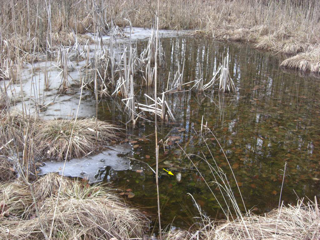
Fig. 19: In March 2010 dead fishes were visible (arrow) floating on the surface in pond 6. Obviously the pond was frozen up to the ground during the winter 2009/2010).
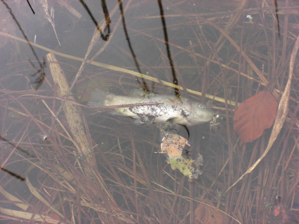
Fig. 20: One of the dead fishes in pond 6 in March 2010.
Fig. 21: A schematic sketch of the ponds after dredging activities in 2010. Pond 9 was new excavated. Pond 2 was widened up to the forest track and pond 6 was deepened. Pond 4 no longer appears on the map as it has since silted up.
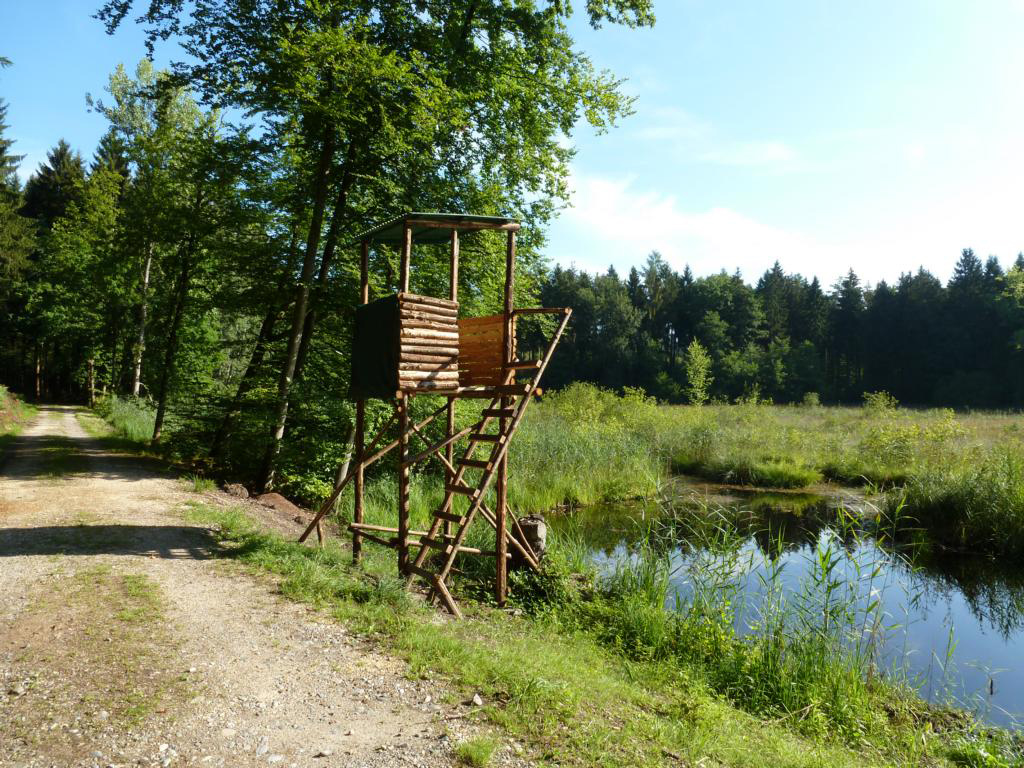
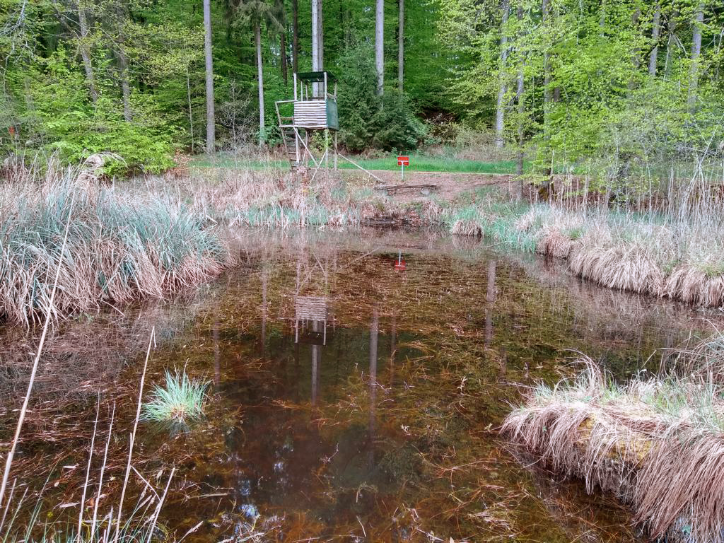
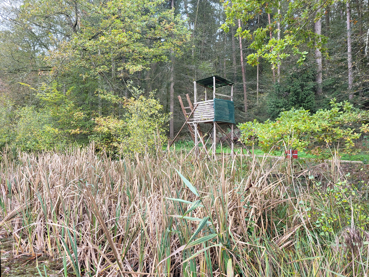
In June/July 2011, the municipality of Allensbach had an observation tower erected on the shore of pond 2, which had previously (in winter 2010/2011) been extended by dredging. This was not erected for hunting, but for walkers, who had a view over the Simmelried from there. Probably for this reason the pine trees in the middle of the Simmelried were cut down to have a clear view to the main pond.
Fig. 22: View over the widened pond 2 in May 2011, shortly before the observation tower was buildt in Juni/July 2011 at the shore (s. Fig. 17).
Fig. 23: View over pond 2 in June 2011.
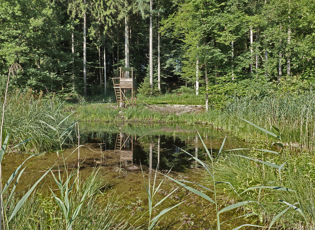
Fig. 24: The erected observation tower between forest track and pond 2 in July 2011.
Fig. 25: View over the pond 2 to the observation tower in July 2011.
Fig. 26: View on the pond 2 taken from the new observation tower in July 2011.
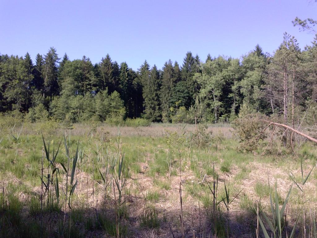
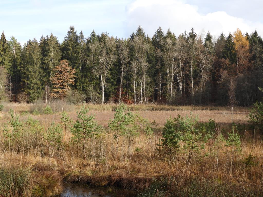
Fig. 27: View across the Sphagnum lawn in June 2013 toward the main pond 1 (not visible in front of the forest edge).
Fig. 28: View from the obseration tower over pond 2 in March 2015.
Fig. 29: View across the Sphagnum lawn in August 2015 from pond 2 toward the main pond 1 (not visible in front of the forest edge).
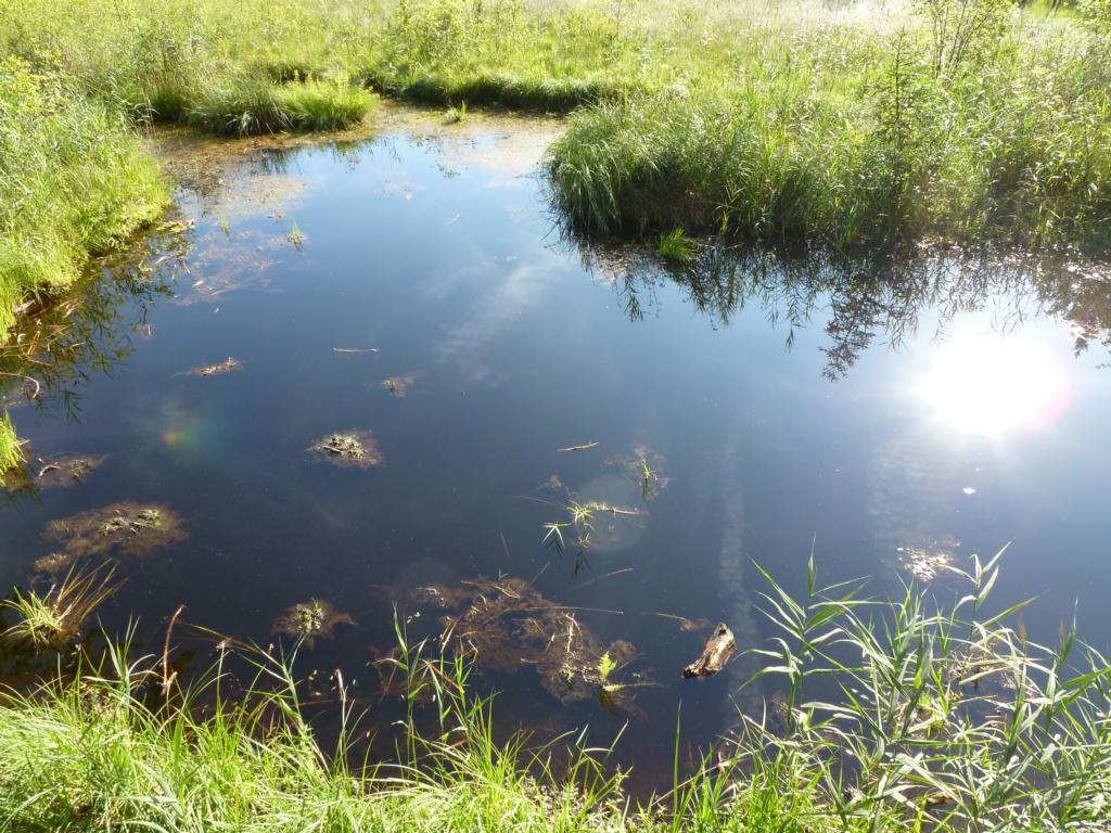
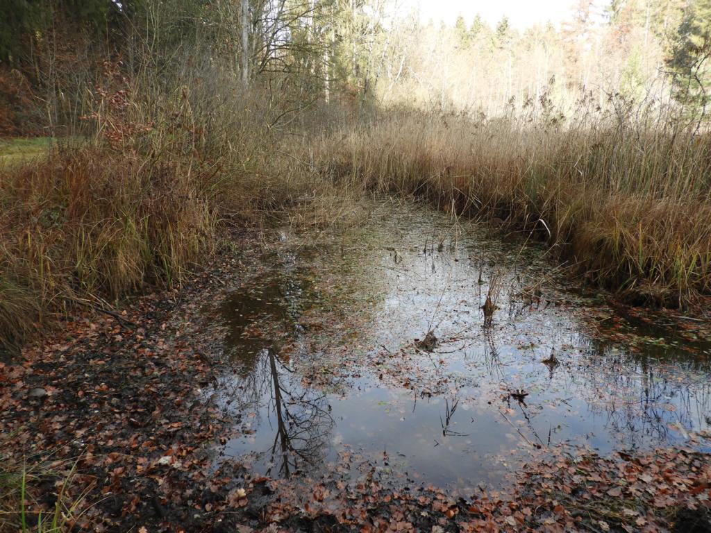
Fig. 30: The outlet channel 8 in August 2015.
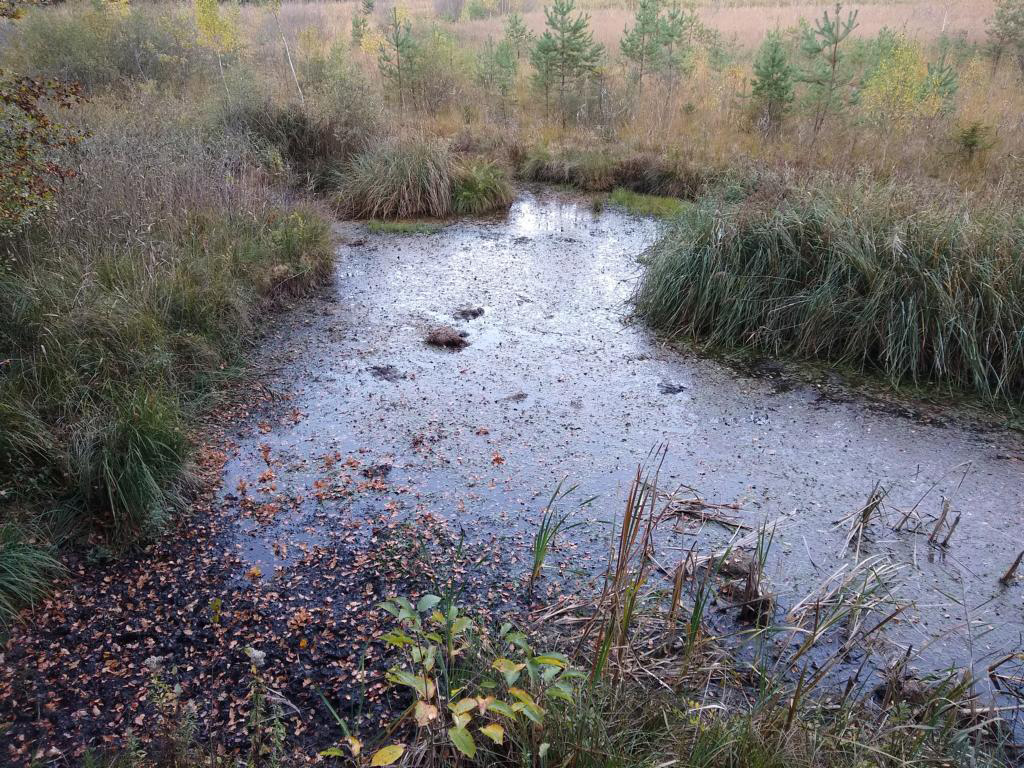
Fig. 31: Pond 9 in August 2015, 4 years after it was created by dredging in winter 2010/2011.
Fig. 32: Pond 6 in March 2015 with a siltation zone of Sphagnum moss.
In 2018, the driest and warmest year on record occurred in Germany. From April to October, there were summer temperatures with about 40% less rain than in an average year. This was not without consequences for the Simmelried. The water level was so low in September that the drainage channel dried up completely and the water level in pond 2 dropped so much that a wide bank area was dry. In midsummer (July, August) the water was also warmer than 25°C during the day.
Fig. 33: The completly dried outlet channel 8 in October 2018. Compare the image with fig. 30.
Fig. 34: The almost dried pond 9 in October 2018.
Fig. 35: The almost dried pond 2 in October 2018. Large parts of the frogsweed (Luronium natans), which usually covers the water surface, had already died by this time.
Fig. 36: View across the Sphagnum lawn in December 2018 from pond 2 toward the main pond 1 (not visible in front of the forest edge).
Fig. 37: The spring 7 in April 2019. The cover with watercress (Nasturtium officinale) appears strongly reduced compared the year 2009 (s. fig. 12).
Fig. 38: View over the pond 2 to the observation tower in December 2019.
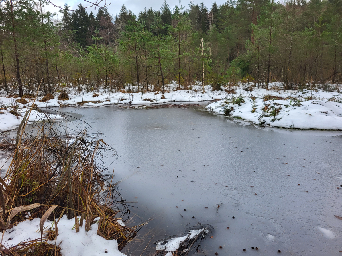
Fig. 39: View over the pond 2 in February 2020.
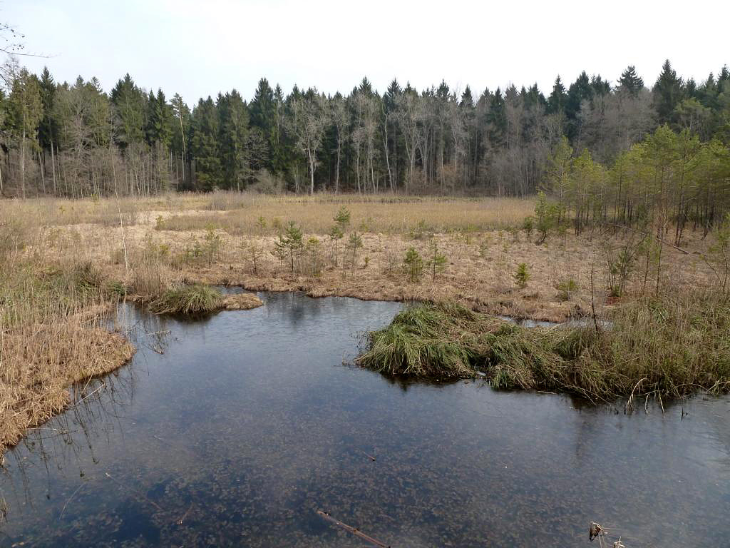
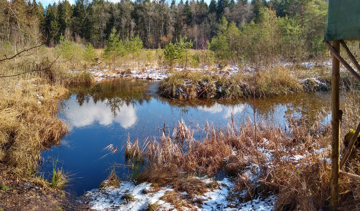
Fig. 40: A view on the main pond 1 from the north in January 2021:
Fig. 41: Pond 2 in October 2023.
Fig. 42: View from pond 2 to the observation tower in October 2023.
Fig. 43: View over the pond 2 in October 2023.
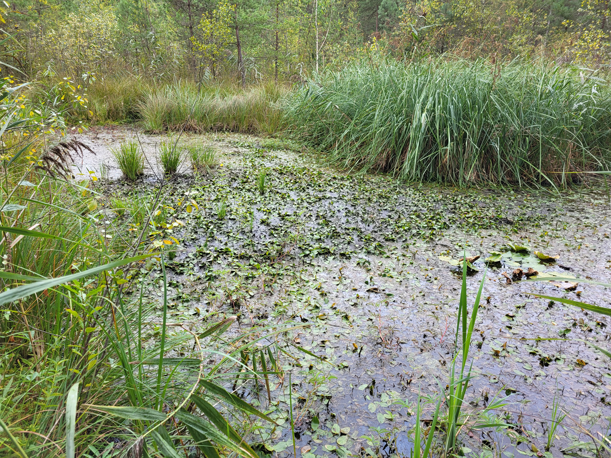
Fig. 44: Floating water plants on the surface of pond 2 in October 2023.
Fig. 45: Pond 2 in Dec 2023.
Fig. 46: Pond 2 in Dec 2023.
Fig. 47: In October 2024, Pond 2 already shows clear signs of silting up. In the middle, tufts of grass can be seen growing where there used to be a continuous water surface..
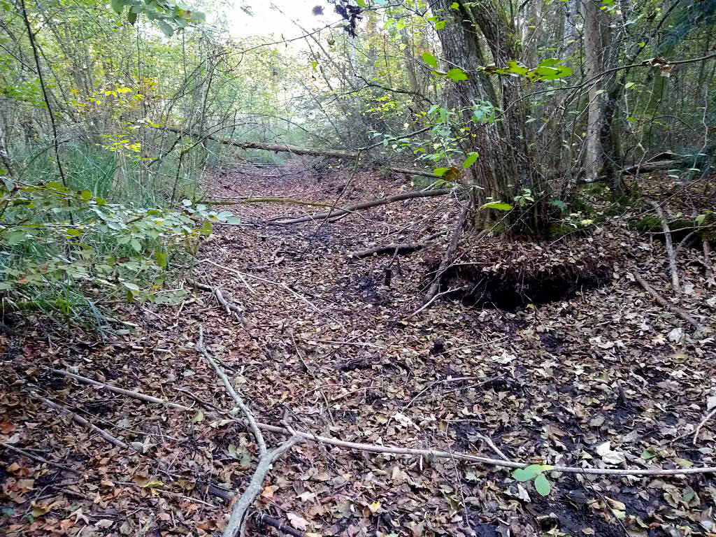
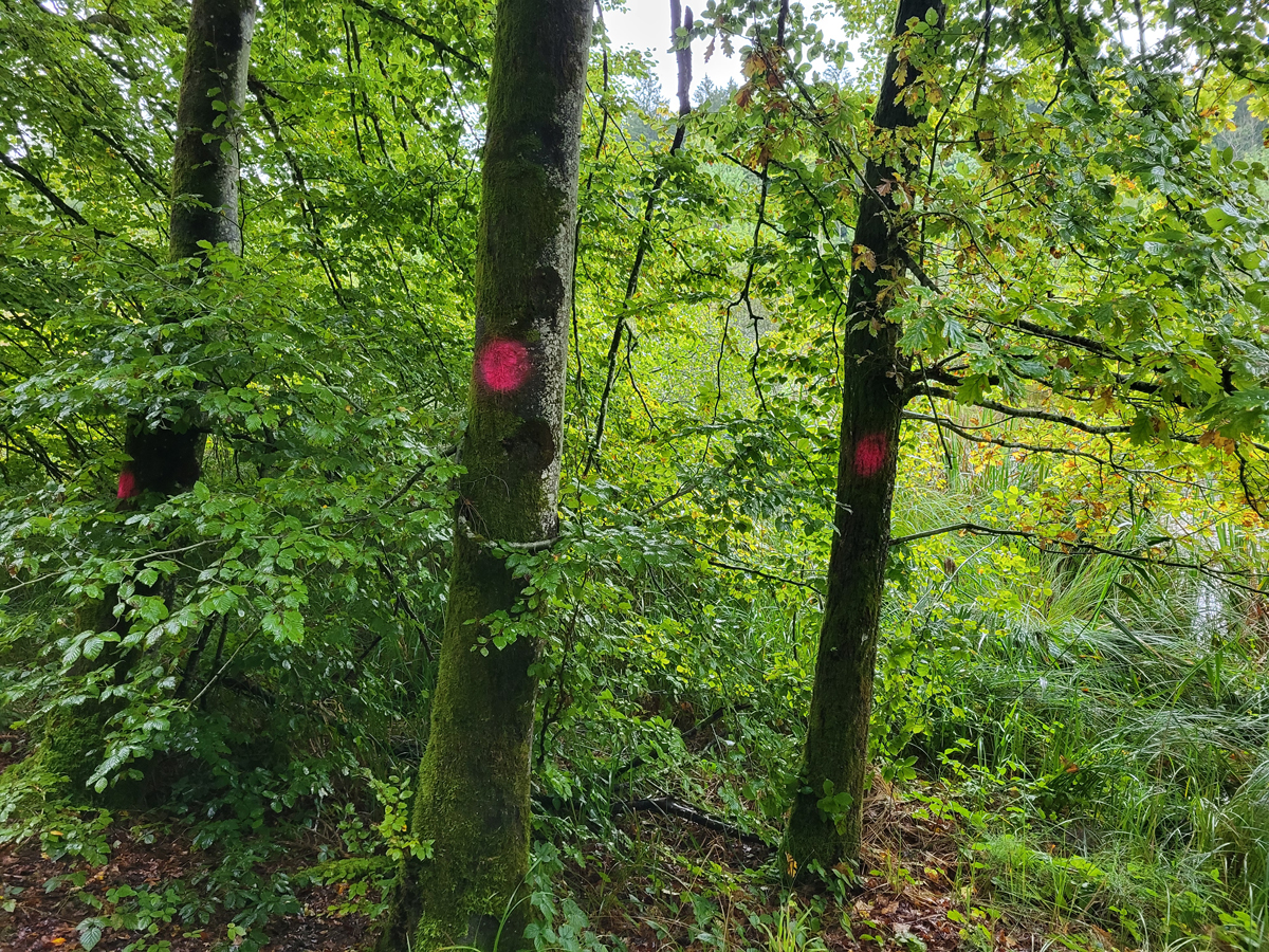
Fig. 48: In September 2025, markings were seen on the trees along the forest paths at Simmelried. These markings indicated an imminent felling of the trees.
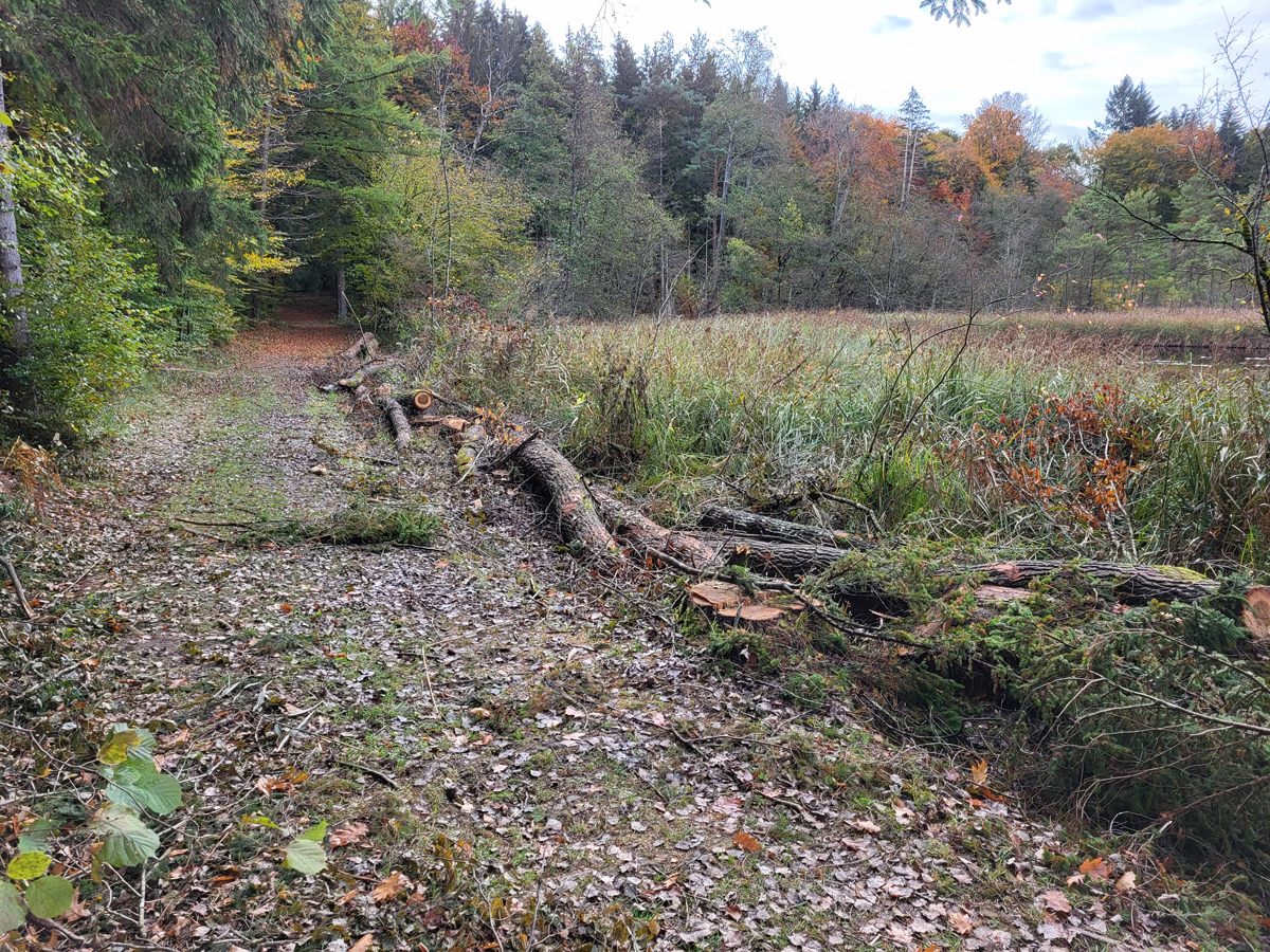
Fig. 49: In October 2024, the trees along the forest paths were cut down. Here is the forest path on the south side of the Simmelried.
Fig. 50: The felled trees on the north side of the Simmelried in Oct. 2024. On the right, the main pond can be seen.
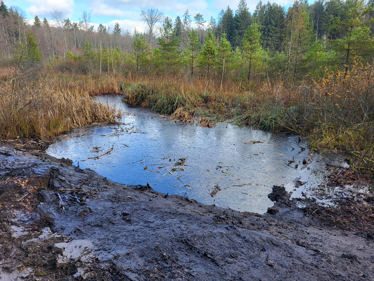
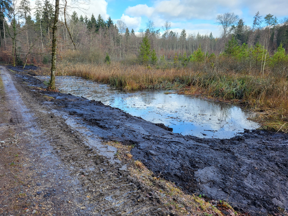
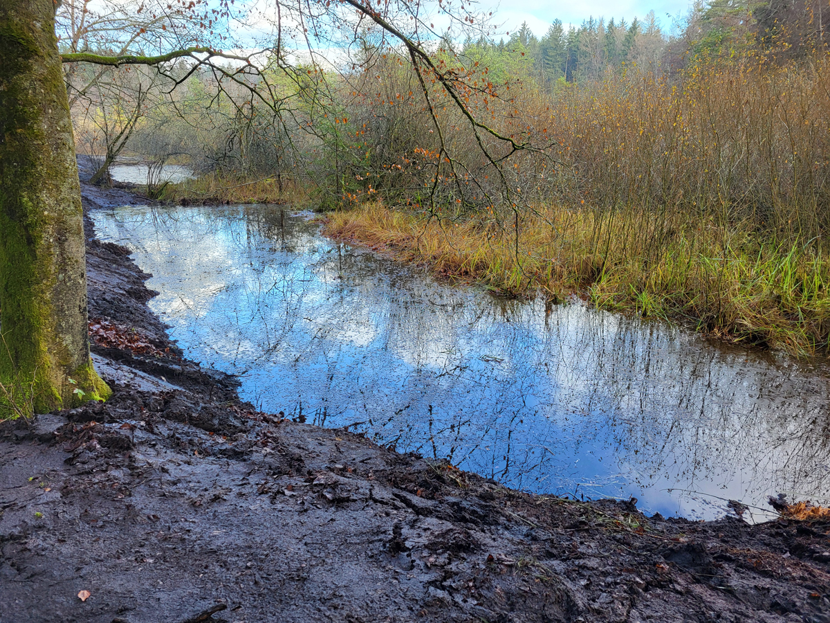
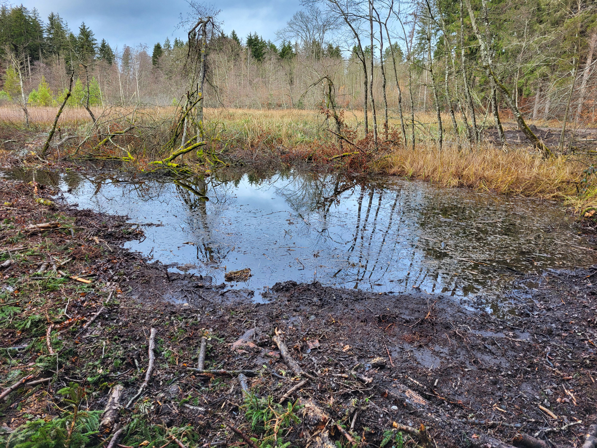
Fig. 51: In November 2025, an excavator was positioned on the forest path on the south side. The excavator was used not only to dig out and deepen the already existing ponds but also to create about 10 additional ponds, which lie parallel to the forest paths around the Simmelried.
Fig. 52: The original pond 2 was deepened and simultaneously enlarged. The excavator spread the dug-up sludge along the shore.
Fig. 53: The original pond 9 was deepened and enlarged to about three times its area.
Fig. 54: A completely newly created pond on the south side. In the background, the pond 2 can be seen.
Fig. 55: One of about 5 new ponds that the excavator created on the north side of the Simmelried.
With the dredging of the ponds, the decades-old and developed layer of sludge in the ponds made up of dead and decomposed plants has been destroyed. The majority of the floating plants and shoreline plants were cleared away. At the same time, the already existing ponds threatened by silting up were deepened and about 10 completely new ponds were created. Since the beginning of my observations at Simmelried in 1992, this is the biggest change so far and represents a new beginning for the animal and plant life. In the coming years, it will be seen in which direction the area will now develop.